A Birder's Guide to Minnesota
~ Fifth Edition ~
• This new edition has been expanded to 464 pages and still includes bird-finding information for all 87 counties (1,400+ locations in all). Also, a 55-page annotated list with all the species found in Minnesota (the list is now up to 452 species through December 2023) includes their status and distribution in the state, plus numerous tips on identification.
• New features added to this edition include birding contacts for each county, QR-code links to online maps and to regular updates with corrections & additions, and nearly 200 photos.
• Note that the First Printing essentially sold out (after only
four months!), but a Second Printing is now completed and became available in May – it includes several minor text revisions, a new cover, and non-spiral binding.
A Birder's Guide to Minnesota, Fifth Edition
~ CORRECTIONS and ADDITIONS ~
As of March 2024
(including those in the four previous sets of updates)
Some of the content in the text had been written as early as 2019; accordingly, some corrections & additions are already necessary. Some of these have been included in the recently released Second Printing, and these are indicated below in black type. There are also more recent changes indicated in red below which do not appear in the Second Printing. In other words, the updates in black indicate information which was not included in the First Printing (November 2022); the updates in red refer to information which was not included in either the Second Printing (May 2023) or the First.
Those newest updates added in this March 2024 collection are marked with an asterisk (*) and located in the following counties: Otter Tail, Douglas, Kandiyohi, Lincoln, Lyon, Watonwan, and Pipestone in the West Region; Carver, Hennepin, and Chisago in the Southeast Region; and Itasca, St. Louis, and Lake in the Northeast Region.
This collection of updates will continue as needed to provide those who use this reference to Minnesota's birding locations with the most accurate and up-to-date information available. Accordingly, please contact the author by e-mail (eckertkr@gmail.com), or by phone / text (218 349 5953), with new information you become aware of so this can be passed on to other Minnesota birders. Also note the county contacts listed on p. 20 - 23 who would also be interested in this information.
My thanks to Jon Beck, Herb Dingmann, Gerry Hoekstra, Doug Kieser, Jim Lind, Linda McGouirk, Brian Smith, and Ben Stubbs who have provided information for some of these updates.
INTRODUCTION
p. ii – A better website than birdnerdz.net for sales of this guide is thephotonaturalist.com.
p. 16 (W, SE & NE Regions) – Besides Minnesota’s three major biomes, Tallgrass Aspen Parkland represents a fourth (and relatively minor) biome. It is limited to parts of Kittson, Roseau, Marshall, Pennington, Red Lake, and Polk counties, has relatively little ornithological significance, and accordingly gets little attention in this guide.
p. 18 – Avenza Maps is no longer recommended for storing maps in the book's QRs. This app is unable read the primary QR codes of several of the counties, and it is not needed to scan and store the contents of any of the QRs – you can download and save them in the same way as other files with no need for Avenza or any other app. Note as well that you can save maps in advance and read them later if you think you'll be birding in areas without wifi or cell service. With your smartphone, go to Google Maps, click on your avatar on the right side of the search line, and on the next page select Offline maps. Next, click on Select Your Own Map, on the next page scroll to the area on whatever map you’re interested in, and click Download. You can then read the map’s contents, add annotations with locations or notes, and navigate while birding in areas with no cell service; note that you should select the Default map type, not Satellite or Terrain, which makes the map easier to use.
p. 19 – Another term used by birders should be included on this page since its definition is often misunderstood: • Boreal = Northern (e.g., as in boreal forest); note that it is not synonymous with coniferous, since boreal forests can consist of deciduous trees.
p. 20-23 – County Birding Contacts:
Add the following to the list of contacts –
• Kittson: Ezra Hosch <emh328@outlook.com>
• Douglas: Ben Eckhoff <benjamin.eckhoff@state.mn.us>
• Freeborn: Ezra Hosch <emh328@outlook.com>
• Fillmore: Todd Mitchell <tamitchell66@gmail.com>
• Meeker: Koni & Paul Fank <condor_puffins@yahoo.com>
Change contact method from e-mail to texting –
• Jeanie Joppru (Marshall, Pennington, Red Lake, Polk counties): 218 280 3977
• Mike Hendrickson (St. Louis County): 218 348 5124
ANNOTATED LIST OF MINNESOTA BIRDS
p. 27 – The MOU Records Committee had recognized a total of 447 species recorded in the state through the spring of 2022, and an additional 5 species have now been accepted. Since this 5th edition went to press in the summer of 2022, Broad-billed Hummingbird, Brown Booby, Phainopepla, Abert's Towhee, and Swainson’s Warbler are now added to the Minnesota list, which includes 452 species as of December 2023 (with the total of Accidental species increasing to 95).
Accordingly, in this Annotated List section, Broad-billed Hummingbird is added after Rufous Hummingbird (p. 37), Brown Booby (and Family Sulidae) added after Magnificent Frigatebird (p. 48), Phainopepla (and Family Ptillogonatidae) added after Cedar Waxwing (p. 64), Abert’s Towhee added after Swamp Sparrow (p. 73), and Swainson’s Warbler added after Prothonotary Warbler (p. 76).
p. 80 – In the Yellow-throated Warbler paragraph (as mentioned on p. 233), it should be added that Hillside Road just north of Reno Recreation Area Campground in Houston County [site 8] is currently the most consistent location for this species, with annual sightings from 2018 through 2023.
p. 82 – With the addition of Broad-billed Hummingbird, Phainopepla, and Swainson’s Warbler to the state list, these species are no longer on the list of 20 possible future additions to the Minnesota checklist; also
add Arctic Loon to this list of possibilities, replacing Swainson's Warbler as one of the 20.
WEST REGION
Kittson County
p. 91 – Like other county landfills, the one in Kittson along the MN 175 / Middle Branch of Two Rivers corridor has potential to attract gulls and some raptors: from CR 5, go 1 mi. west on 175 to 290th Ave. and 0.5 mi. north to the entrance.
Pennington County
p. 104 – Wayne Johnson still welcomes birders to contact him by text for access to the Thief River Falls sewage ponds [site 4]: his number is 218 689 8967 (texts only, no calls). It is best not to use the office phone number and e-mail address cited on this page.
Polk County
p. 112 – The conifers in the southwest part of Lengby [site 25] are by St. Paul’s Church on CR 201.
Otter Tail County
* p. 128 – The egret-cormorant rookery at Grotto Lake [site 11] was damaged by a July 2023 storm, and most or all nests were abandoned; accordingly, there may not be any birds nesting here subsequently. The few pairs of Black-crowned Night Herons nesting nearby in more sheltered trees may have weathered the storm better; if not, however, and none return in 2024, it's possible this species will actually become extirpated as a nesting species in Minnesota (since this modest colony at Grotto L. may have been the state's largest).
Grant County
p. 139 – The parking spot for access to Mustinka WMA [site 4] is 1/4 mi. west (not east) of the WMA.
Douglas County
* p. 143 – Clifford Lake Rd., which leads to the Osakis sewage ponds, turns south off CR 82, not MN 27;
this former state highway was changed to a county road.
Kandiyohi County
* p. 167 – The Carlson Dairy area [site 3] was still dry without any mudflats or visible in March 2024, and it seems likely this site will no longer be productive for birding.
* p. 168 – There is also good mixed habitat with birding potential along other roads near 115th Street [site 13]: one is 130th St./CR 135, which parallels 115th a mile to the east; another is 228th Ave., the first east-west road between 115th and 130th you come to north of MN 23.
Yellow Medicine County
p. 174-175 – The road east from MN 23 along the south side of the Minnesota River to the state park is now signed MN 167. (MN 67 now turns east off 23, 2.2 mi. farther south, and is then concurrent with MN 274 going south to Wood Lake.)
Lincoln County
* p. 179 – The relatively extensive woodland for migrant passerines in Picnic Point County Park at Lake Shaokatan [site 9] is probably the county's second-best wooded site; only Hole-in-the-Mountain County Park [site 15] would be better.
Lyon County
* p. 183 – Island Lake [site 8] has had better birding for shorebirds, waders, and other water birds in recent years than less accessible Highpoint Lake [also site 8]; if there is time to bird only one of these lakes, most birders would choose Island L.
Redwood County
p. 187 – Bell’s Vireo has been found in 3 consecutive years (2021-2023) at the northern tip of the county near the Minnesota River: from the junction of CR 7 & 440th St. [site 1], go 1 mi. south, 1 mi. east, and 0.6 mi. south on Grandview Ave.
p. 188 – Aspen Avenue [site 7] is a mile east of the Lyon county line (not inside the line).
Brown County
p. 190 – Of the US Highway 14 wetlands west of New Ulm [site 7], the best one recently has been Somsen WMA on the north side of US 14: turn north on CR 12, 0.9 mi. west of the Walmart.
Watonwan County
p. 192 – The water levels at the 320th Street Wetland [site 1] were managed and became too low in 2022, and the birding was not as productive as in previous years; hopefully, though, this situation is only temporary. * Unfortunately, water levels did not recover much in 2023, and in March 2024 the area was mostly morsh with the only open water visible along 320th St. limited to a smaller area a half mile east of tthe highway, without any mudflats or walk-in access as before. It seems unlikely that this wetland will be nearly as good in future years as it once was.
p. 193 – Meadowlark Prairies Outdoor Lab (33672 733rd Ave.) is a mostly wooded area just northeast of St. James with edge habitats to attract migrant passerines, and with good potential as well for breeding species and winter visitants. From downtown St. James, go east on 1st Ave. S to 11th St. S / CR 54, then 0.5 mi. north, 0.2 mi. east, and 0.3 mi. north to the sign and main trailhead.
Pipestone County
* p. 202 – There are alternate spellings of Minett-Krintz Reservoir [site 2], and Minett-Kranz seems to be favored by the DNR. Regardless of the spelling, note the small grove of planted pines here which are always worth checking in western Minnesota for roosting owls or finches.
p. 202-203 – The city of Pipestone now requires that birders get an annual permit before entering the sewage ponds [site 6]. Joel Adelman continues to be a good contact person, but for a more direct way of obtaining a permit, contact Jeff Jones’ office at (507) 825 3324.
Nobles County
p. 209 – One of the best wetlands in southeastern Nobles Co. is along Quine Avenue: e.g., Cinnamon Teal, Black-necked Stilt, and White-faced Ibis were all found here on a single day in May 2022. From the CR 57 access to Ocheda Lake [site 8], continue 1 mi. south, 0.5 mi. east to Quine Ave., and another 0.5 mi. south.
p. 210 – The number to call for vehicle access to the Adrian sewage ponds has changed: contact Kendall at (507) 841 3574.
Jackson County
p. 213 – In the Sioux Valley area [site 11], better access and birding for Skunk Lake is at the WMA on the south side of the lake. From Sioux Valley, go 2.5 mi. east on CR 4, then zigzag south-east-south-west on 410th Ave. for 2 mi., then back north on the two-track road through the WMA’s mixed habitats.
SOUTHEAST REGION
Houston County
p. 232 – There is a small pull-off for viewing the MN Highway 16 wetland [site 3]: it’s on the south side of the highway, 2.0 mi. east of CR 25 or 0.1 mi east of Ryan Rd.; if coming from the east from Hokah, look for it 3.5 mi. west of the MN 44 junction.
p. 232 – Mound Prairie SNA [site 4] includes two tracts south of MN 16, which are easier to access than the area off Carlson Rd. on the north side of 16 (the trail uphill from that pull-out to the SNA is usually overgrown). To reach the southern tracts: go 0.5 mi. west from Carlson Rd. on MN 16 to Mound Prairie Dr., 0.1 mi. south to Golfview Dr., then east as Golfview becomes Hidden Valley Dr., and after the curve south you’ll see a SNA sign on the left; the road ends shortly after that at a trail leading left and uphill to a another SNA section.
p. 233 – Yellow-throated Warblers have still been present in 2022 and 2023 about 1/4 mi. north of the Reno Recreation Area campground [site 8]; however, they can be difficult to see, so listen for the song in the tall pines along Hillside Rd.
p. 234 – The easement to access Gordon Anderson Recreation Area [site 13] appeared to be discontinued in May 2023, as the access road has become a private driveway. It is unknown if this change is temporary or permanent, or if the area can be reached another way from CR 2.
Wabasha County
p. 241 – The gate at the two-track road at McCarthy Lake WMA [site 4] is now usually left open; if so, it’s OK to drive in and park away from CR 84 (where parking is difficult).
p. 241-242 – There are additional accesses to the woods and wetlands along the Mississippi River backwaters between Weaver and Kellogg, which are shown on Upper Mississippi River NWR maps:
• Two of these are along 622nd St., which turns east off CR 84, just north of the McCarthy Lake WMA sign [site 4]: i.e., the West Newton Chute and Halfmoon Lake landings (see map at fws.gov/sites/default/files/documents/Pool5%20%28Front%29.pdf).
• Three others are north of Lock & Dam #4 [site 6]: i.e., 0.4 mi. north of the dam at the corner of 657th St. and 140th Ave. (not labeled on the NWR map, but probably the best of these three), and Peterson Lake and Wilcox landings (see map at fws.gov/sites/default/files/documents/Pool4%20%28Back%29.pdf).
p. 242 – To reach Reads Landing [site 7], turn down to the river off US 61 at the inconspicuous CR 77 sign, 3 mi. northwest of MN 60.
p. 243 – Acadian Flycatcher and Louisiana Waterthrush have occurred in recent years (including 2023) near Carley State Park [site 14] along the north branch of the Whitewater River, just across the Olmsted County line. Then, in 2023, they were joined by a Yellow-throated Warbler: listen in the pines on the ridge above the river. From the state park’s entrance road, go 0.5 mi. south on Wabasha CR 4 / Olmsted CR 10, then east on 72nd St. for 1.5 mi. to its end, and hike south and east on an old two-track road down into the woods along the river.
Waseca County
p. 253 – There are now small sewage ponds at Waldorf, 1 mi. northwest of town on MN 83.
Sibley County
p. 263 – The former Le Sueur sewage ponds [site 1] can still be scanned from the side road to the public access immediately west of the river or from the shoulder of southbound US 169, but there is no longer good access a half mile west of the river off 169.
p 264 – While Sand Lake [site 8] is visible from the public access on MN 15, 3 mi. south of Winthrop, there are better views from 310th St. west of MN 15 on the north side of the lake.
Rice County
p. 269 – Among the lakes of secondary interest in the county is Circle Lake, which has two sites of note. One is its county park: from I-35 at exit #66, go 2.4 mi. west on CR 1, then 0.8 mi. southwest on Circle Lake Tr. The other is Canby Pond, adjacent to the east end of Circle L. (often attractive to waders and sometimes shorebirds): from I-35, go 1.4 mi. west on CR 1 to Canby Ave. / CR 60, 1.0 mi. south to 120th Court, then west and north along the west side of the pond.
p. 269 – The best place recently to look for Acadian Flycatchers and other specialties at Nerstrand Big Woods State Park [site 3] has been east of the campground along the Hidden Falls Trail.
p. 270 – At Koester Prairie [site 9], Bell's Vireos were present in 2022 about 1/4 mi. east of the trailhead and WMA sign on Lamb Ave., 0.9 mi. south of CR 31.
Goodhue County
p. 272 – From Red Wing, the easiest way to Colville Park [site 5] is via US 61: turn south at the first MN 292 sign, 1 mi. east of the stoplight at US 63.
p. 274 – In the Prairie Island area, the road to the casino (Sturgeon Lake Rd.) is marked by a relatively inconspicuous stop sign on CR 18 that can be missed. This road brings you first to the casino: next turn left at the sign for the marina on Sturgeon Lake [site 13]: then return to Sturgeon Lake Rd., continue to the curve going right, and jog left to another public access at the backwaters; and rerurn to the main road which becomes Wakonade Rd. leading to more backwaters and the lock & dam [site 14].
Dakota County
p. 276 – The trail on top of the levee in the Lake Rebecca area [site 3] extends from the dam, west past the north end of Lake Rebecca, and eventually to CR 42. Also be sure check the Washington County side of the river north of the US 61 bridge – a Roseate Spoonbill stood on the flats here a few years back.
p. 277 – In Sept 2023, the side road off Pine Bend Trail [site 4] leading to Bud's Landing was signed as Fischer Ave. and was not gated; follow this road to the fork and bear left to the unsigned boat landing which provides a wide view of the Spring Lake backwaters.
p. 277 – Fortunately, the 140th Street Marsh [site 5] has mostly recovered from the impact of the extension of the adjacent landfill in 2020. In addition to the Willet, White-faced Ibis, and Bell’s Vireo seen here in 2021, during 2022 there were reports of 24 shorebirds (including avocet), another Bell’s Vireo, Lark and Henslow’s sparrows, and Blue Grosbeak.
p. 277 – Between Pine Bluffs SNA [site 7] and Rock Island Swing Bridge [site 8] is River Front Park on River St.: turn east from Concord Blvd. opposite 78th St. on Dickman Tr., and bear right on 77th St. to the park and a view of the Mississippi. There are extensive riparian woodlands as well along the 2-mile length of River St., from its south end (3/4 mi. south of the park) to its north end on 66th St. (where you're just west of the swing bridge).
Carver County
p. 287 – The gated trail a half mile from the Sibley Co. line on CR 40 [site 1] has been abandoned, is overgrown, and no longer passable.
p. 287 – The trails in Minnesota Valley NWR [site 2] on Rapids Lake Rd. west of the Rapids Lake Visitor Center and from the North Hunter Lot on CR 11 mostly pass through grasslands before coming to the woods; look for Henslow Sparrow and other species partial to such open terrain.
* p. 288 – The sightings of Townsend's Solitaires and occasional roosting owls along Grimm Road [site 4] tend to be around the west end of Grimm and the south end of Springvale Rd. (which turns off Grimm Rd., 0.6 mi. west of CR 11). Also listen for American Woodcock in spring west of the Grimm/Springvale corner, especially around the Grimm Farm historuc site.
Meeker County
p. 294 – The road which turns off CR 25 to the Grove City sewage ponds is now signed Gun Club Rd.
Wright County
p. 297 – Amended directions to the public access on the north side of Pelican Lake [site 6] at Fallon Avenue: from CR 37, go 100 yards south on Fallon Ave. (not to the end of Fallon), then east at the public access sign to Holker’s Landing.
Hennepin County
* p. 303 – The east end of the trail through T. S. Roberts Sanctuary [site 23] is at the signed Peace Garden parking lot on Roseway Rd., just northeast of one-way Lake Harriet Blvd., near the northeast corner of the lake.
* p. 303 – The main (only?) entrance to Lakewood Cemetery [also site 23] is at the end of Hennepin Ave. at 36th St. (i.e., 3600 Hennepin Ave S).
* p. 304-305 – The route between Bde Maka Ska [site 31] and Lake Harriet [site 30] can be confusing. Going from north to south, William Berry Pkwy. runs into Lake Harriet Blvd., which then splits into two one-way sections. And going the other way, south to north, can be just as disorienting. Rather than try to give verbal directions here, it is best to navigate in this area (which includes Lakewood Cemetery and T. S. Roberts Sanctuary [site 23] ) using Google Maps, your car's navigation system, or other navigation apps.
p. 305 – The directions to French Lake [site 33] include Brockton Ln., which is also named CR 13.
Anoka County
p. 319 – If birding Centerville Lake in summer [site 13], be aware of the Acadian Flycatchers found in at least the past two years about a mile west of Centerville L. Find your way up to I-35W, take the Lake Dr. / CR 23 exit (#36), go 1.2 mi. south to Aqua Ln., then turn 0.6 mi. east, and listen on the south side of the road.
Chisago County
* p. 321 – Amended directions to the public access at Green Lake [site 4]: from US 8, go 2 mi. south on CR 24 to the traffic circle, then bear right (southwest) on CR 23 for 1 mi.
p. 322 – The best (and perhaps only) access to Lawrence Creek SNA [site 9] is from the Unity Ave. parking area, though the signed trail going west from there and down to the creek is often steep and the hike difficult. At the creek, turn left/downstream as the trail becomes inconspicuous at times but leads to where Acadian Flycatchers and Louisiana Waterthrushes were still being seen in 2023 (along with Winter Wrens).
Sherburne County
p. 327 – The county map does not clearly show MN Highway 25; it runs between Monticello (Wright Co.) and Big Lake, is then concurrent with US 10 going northwest for 9.5 mi., and turns north into Benton Co.
p. 328 – The parking lot on the Sherburne side of the Mississippi opposite Monticello [site 3] no longer has an actual church but still provides a view of the river. When traveling northwest from MN 25 on CR 11, however, you cannot turn left to access this lot: accordingly, go 0.3 mi. northwest from 25 on CR 11, turn around at the driveway on the right, then return southeast to 187th Ave. and turn right.
p. 328 – Oak Savannah County Park is a consistent place to find grasslands birds, such as Bobolink, Lark and Grasshopper sparrows: from US 10 in Becker, go 0.5 mi. north on MN 25, and 0.5 mi. east on 125th Ave. to the park entrance.
p. 330 – The Clear Lake sewage ponds were still in use with birding potential as of May 2023. An alternate, unsigned access road from the north turns south off CR 8, just southeast of MN 24; after 0.7 mi. it is posted No Trespassing, but it has been OK to walk in beyond there to view the main pond.
p. 330 – Amended directions to the Zimmerman sewage ponds: From CR 4 / Fremont Ave., go 0.8 mi. south on 2nd St. E through town and past the disc golf course, then turn right at the gate to the city compost site, and continue another 0.2 mi. south.
Benton County
p. 331 – Other accessible woods along the Mississippi River in Sauk Rapids [site 1] that are often good for migrant passerines lie along Riverside Drive between 3rd and 7th streets NE.
p. 332 – One stand of pines that has attracted Red Crossbill is on CR 2, 0.6 mi. east of the Benton Beach County Park entrance [site 3]: despite some misleading signage, it’s OK to walk south into the state forest land opposite the corner where 5th Ave. NE turns north.
p. 332 – Common Raven and Northern Waterthrush (presumably nesting) were also found in 2023 in the Little Rock Creek area along 160th St. [site 5]. Farther south, the creek flows through additional bogland habitats in Sartell WMA: to reach one WMA access, go 0.5 mi. west from the creek crossing on 160th, then 1.3 mi. south on 15th Ave. NW.
p. 332 – To reach the best access for viewing the Rice sewage ponds: drive around the west side of the ponds to the end of the road on their south side.
Stearns County
p. 334 – Sauk River Regional Park is one of the best places for woods birding along the Sauk R. in St. Cloud: after crossing the river on CR 1, continue northwest and take the second exit at the traffic circle, then southwest on CR 120 to the sign for Dolores Dr. and the regional park, just before the MN 15 intersection.
Morrison County
p. 343 – The meadows near MN 27 [site 1] just east of the Todd county line are still productive, as evidenced by a July 2023 sighting of a Nelson's Sparrow at Irish Creek on 140th St., a mile south of 27 and 0.4 mi. east of the county line/10th Ave.
NORTHEAST REGION
Pine County
p. 355 – The directions to Gandy Dancer Forest Road [site 6] should include going north on CR 31 to Cloverton (as shown on the county map) – not Cloverdale.
Aitkin County
p. 364 – Another access to view the NWR's Rice Lake [site 8] is via 240th Place, which turns north off CR 4, 3.6 mi. west of MN 65. Go 1.7 mi. north on 240th to where it turns east, and at this corner an old road/trail goes 1/4 mi. northwest to the lake shore.
Beltrami County
p. 386 – Moose River Dike Road [site 4] is signed as open to vehicles from mid-July to mid-September only, but there are good views of open water and marshes at both gated ends. From Fourtown, the south gate is a total of 9 mi. on CR 44 (which zigzags north-west-north-west from “town”), then 1 mi. north on signed Dike Trail. From Fourtown, the north gate is 12.5 mi. north on Fourtown Rd. / Dick’s Parkway, 4 mi. west on Moose River Forest Road [site 5], then 2.3 mi. southwest on the dike road.
When the dike road meets Moose River Rd., it jogs east a bit and continues north as an unsigned and non-gated two-track road to a T at Morehouse Forest Rd. [site 6]; this road goes east back to Dick’s Parkway (and there is no gate here either).
p. 386 – The best views of Lower Red Lake from the Ponemah Road [site 10] are 3.5 - 4.5 north of MN 1. To reach the point between Lower and Upper Red lakes, take the right fork on the loop road 5.5 mi. beyond Ponemah, then continue 0.6 mi. and turn right to a boat landing for your only real view of Upper Red L. However, the birding on both lakes (when you can see them) tends to be on the slow side, the woods along Ponemah Rd. are deciduous and disappointing as well (except for that point between the lakes), and this route takes you miles out of your way with little to show for it if no migration is going on.
p. 387 – If heading next for the eastern half of Upper Red L., turn north at the unmarked paved road immediately west of the Ponemah community center, go 10.5 mi. north and east to the reservation border, where the road becomes CR 108 and continues 3.8 mi. east to Shotley and eventually to MN 72 via CR 23. From west to east on 108 and 23: you can scan the lake at the WMA public access (turn north, 0.8 mi. east of the reservation boundary) [site 12], 1.8 mi. north of Shotley at the corner where CR 23 turns east, and 1.5 mi. farther east at Rogers Rd. [also site 12].
p. 387 – In the Waskish area of wild rice paddies [site 13], those along CR 111 are 1-2 mi. north of CR 23 (not MN 23). And those at the east end of Steel Bridge Rd are now posted and have no access.
p. 387 – Waskish Road / CR 112 [site 15] is also numbered as CR 40 on some maps.
p. 389 – Amended directions to Ponemah sewage ponds: 0.4 mi. north on unsigned road immediately east of the community center.
Lake of the Woods County
p. 391 – Recently published reports indicate that single pairs of Piping Plovers had apparently nested at Morris Point [site 3] in four of the past five years.
Koochiching County
p. 398 – Despite construction of a wide power line corridor and continued logging, the habitat on County Road 13 [site 10] was still productive in summer 2022, with records of both sought-after woodpeckers, Canada Jay, Boreal Chickadee, and other coniferous specialties.
Itasca County
* p. 402 – An area with an open landscape and a birding potential similar to Priem Road [site 2] lies along Pincherry Road farther south off US 2 near Cohasset. Turn north off 2 just west of town on signed Pincherry Rd./CR 88, and follow this road as it zigzags north and west. The fields and other open habitats are generally 3-5 mi. and 6-7 mi. from US 2.
* p. 402 – Another coniferous bog not far to the west of the Old Highway 6 Bog [site 5] is along CR 37, a hall mile or so east of MN 46: turn east off 46 on CR 37, 1.4 mi. north of the CR 9 junction. Connecticut Warbler and Yellow-bllied Flycatcher were found here in June 2023.
p. 402 – Delete Sunset View [site 6], which is now a private residential area with a gated entrance road and no lake access.
p. 402– Amended directions to Bowen Lodge [site 6]: from the junction of CR 9 and MN 46, go 3.8 mi. north to CR 148 / Williams Narrows Rd., then 0.5 mi. west to the fork, and left on Bowens Rd. for 3 mi. to the lodge.
St. Louis County
p. 408 – Lafayette Square at 31st St. [site 2] is on the Lakeside of Park Point (not the Bayside).
p. 408 – When water birds concentrate in spring on the Lake Superior side of the Park Point Recreation Area [site 3], the largest numbers tend to be earlier in the morning; by mid-morning, they often drift east out on the lake farther from shore and become less visible. This is especially true in early to mid-May when concentrations of 100 or more Red-throated Loons have occurred: this is usually during the first hour or so after sunrise, with few – and sometimes none – still present after then.
p. 409-411 – Due to a long-term construction project, there will be times with closures and detours related to I-535 and the Blatnik Bridge in Duluth during the next few years. This may impact access to the Port Terminal [site 7], Interstate Island [site 8], and Superior, WI. Currently, the only access to I-535 is via Garfield Ave. from either Superior St. at 16th Ave. W, or from the west end of Railroad St.
* p. 410 – Though the Erie Pier area [site 10] is still posted and technically off-limits (though still often entered by fishermen, dog walkers, and others), the new hiking/biking Cross City Trail passes near it just west of 40th Ave. West – and is not posted with No Trespassing signs. From the yellow gate at 40th (where there is signage for the Cross City Trail), follow the paved trail west next to the gravel road until the road turns left, crosses some railroad tracks and leads to Erie Pier. Here, where the trail continues west under the Hwy. 2 bridge and beyond, there are no signs which prohibit walking down this road to the impoundment.
* p. 411 – If checking for gulls at the landfill in Superior, WI at the base of Wisconsin Point, it is usually worth checking nearby Gull Bluff, a good vantage point for scanning Lake Superior for ducks, jaegers, gulls, and non-common loons. Continue east on the road past the landfill for 1/2 mile, and turn left on the unmarked road leading north to the lake. (Note these roads may not be plowed in winter.)
* p. 412 – In Morgan Park [site 14], a new area near the Beverly St. access is a much better site on the river under development in March-April 2024, with extensive mudflats and shallow water channels. The area is currently private U.S. Steel property (though dog walkers and others go out there anyway), which is due to be transferred to the city later in 2024 and open to all. Indeed, this looks like the best single spot along the St. Louis River for spring waterfowl and waders, for shorebirds both spring and fall (unless water levels rise too much), and for field birds like pipits, longspurs, and sparrows. Instead of turning left on Beverly St. to the ballfield/playground, continue straight on 88th Ave. W for 3 more blocks, and turn left on Falcon St. to the small parking lot. There is access here to the paved hiking/biking trail along the old railroad tracks with signed side trails leading to the flats. (The main paved trail along the tracks then continues south to Mud Lake [site 16].)
* p. 412 – If any No Trespassing signs are posted by the railroad viaduct where birders park to access Mud Lake [site 16], it’s long been OK for fisherfolk, hikers, and birders to disregard them and walk under the viaduct a short way to the abandoned railroad tracks, and then to the right (north) along the tracks to Mud Lake (and beyond to Morgan Park [site 14] ).
* p. 412 – The views of the backwaters in Fond du Lac [site 17] from 131st Ave. W have become more limited in recent years. But there is a better view nearby from end of 1st St. which turns off nearby 130th Ave. W (130th turns south off MN 23, 1 block east of 131st).
* p. 416 – If looking for views of Lake Superior at 40th Ave. East (see column 1), try the east side of the Ecumen Lakeshore building; also check nearby off London Rd. behind the Zvago residence at 39th Ave. E and behind Chateau du Lac at 38th Ave. E.
p. 416 – Probably the best place to park and scan Lake Superior at the mouth of the Lester River [site 23] is behind the University of MN limnology building at 6008 London Rd.: turn in at the driveway off London Rd., either immediately west of the river or at the 60th Ave. E intersection.
p. 421 – The Sharp-tailed Grouse lek [site 32] may no longer be active. Only 2 displaying males were still present into spring 2022, and none has been reported there since then as of December 2022. Sharp-taileds can still occur randomly at other sites in Sax-Zim, with probably the best place to look along CR 7, 1-2 mi. south of Sax.
* p. 421 & 422 – The new Sharp-tailed Grouse lek about 1/2 mi. south of Sax Rd. and about the same distance west of CR 7 is small, distant, and difficult to see from either road. However, grouse are often spotted along this stretch of the County Road 7 corridor [site 37].
* p. 423 – There is also a Superior National Forest office in Tofte in Cook County.
p. 423 – After virtually no documented reports ever in the heavily birded Sax-Zim Bog, a handful of confirmed Spruce Grouse records (some photographed) started to occur at various sites there in 2022 and early 2023. These have all been since the wildfire in fall 2021 along Lake CR 2, an area where Spruce Grouse have consistently occurred for decades (see p. 437-438). There is speculation that some of these grouse were displaced by the fire and accordingly turned up at Sax-Zim.
Lake County
p. 430 – Between Knife River and Two Harbors, Larsmont Cottages (follow the signs on Scenic 61, 2 mi. after Knife River) has potential during migration, since this development has a view of L. Superior (via the trail to the sauna behind the office/restaurant building) and semi-open terrain with edge habitats between the cottages.
p. 430 – East Stanley Road in Two Harbors has again become a private residential road with no birding access.
* p. 432 – Just as you leave Two Harbors and start heading up the North Shore on MN 61, there is a spot worth checking for migrants of all kinds, a half mile northeast of First St. Turn right on signed Burlington Rd., and take the first road on the right at the Burlington Bay Lakehomes sign: this leads to brush piles and a rocky, weedy open area for sparrows and other like-minded species partial to the edges. Also look for the inconspicuous road here going downhill to the lake, and scan this side of Burlington Bay for ducks, grebes, and loons, which might be more visible here than from First St. back in town.
p. 433 – The former AmericInn en route to Black Beach Park [site 12] is now named Grand Stay Black Beach Inn.
Cook County
p. 443 – Upper Cliff House Rd. at Lutsen Resort [site 8] is worth birding for sparrows and other migrants partial to open areas. From the main entrance road to the resort, turn west at the sign immediately south of MN 61, and check the fields and edges along this 1/4-mile-long road.
p. 448 – The Grade [site 28] going west from the Sawbill Trail to Lake Co. is signed at 14.8 mi. north of Tofte Lake Co., but this section of the road is not often birded. The most productive part of The Grade (also signed) turns east off the Sawbill at 17.0 mi. north of Tofte: look especially for Spruce Grouse, both woodpeckers, Boreal Chickadee, and crossbills in the first few miles east of the Sawbill Trail.
p. 449 – Although birders have long been visiting the Lutsen sewage ponds [site 9], some birders there were recently asked to leave. It is possible this new restriction is only temporary, and that other public works staff would allow access.
The retail price of A Birder's Guide to Minnesota is $34.95 for the First Printing ($37.50 incl. sales tax), or $39.95 for the Second Printing ($42.50 incl. sales tax), with some discounts applicable (e.g., for MBW participants). In addition to the usual retail and online outlets, it is directly available at a discounted price, with no shipping charges from...
• For those in the Twin Cities: contact Craig Mandel, who will be distributing books from his
residence in Minnetonka. To arrange picking up a copy, call or text Craig at (952) 240 7647:
your discounted payment will be $32.00 (First Printing) or $37.00 (Second Printing), due at
the time of your pickup. This can be by check (payable to Kim Eckert), or cash, or bank transfer
via Zelle. Note that these amounts include sales tax and represent a $5.50 discount off the
regular price – and you have no shipping/postage charges to pay.
• For those in the Duluth area: contact the author by phone/text at 218 349 5953, or by email
at eckertkr@gmail.com) to arrange a time and place to pick up a copy. It is available seasonally
as well at the Sax-Zim Bog Welcome Center and at Hawk Ridge Bird Observatory.
• Of course, the book will available at all MBWeekends (and discounted to $32.00 or $37.00 tax
included). Other outlets include AdventureKeen Publications, Buteo Books, Amazon.com, and
Sparky Stensaas has it for sale at his website (thephotonaturalist.com),
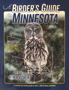
Second Printing Cover
PLEASE NOTE: As described on p. 17, the base map for each county
has an associated QR code printed below it leading to a more detailed
county map. However, some readers have told me they have not been
using these codes, and accordingly they are missing a considerable
amount of useful information. All these QR maps are far more
comprehensive (showing all roads, place names, lakes/rivers and other
natural features), and many include numbered birding locations
cited in the text but not shown on the base county maps. You can also
click on place names on these maps which then link to Google Maps
with GPS coordinates to facilitate navigation with your smartphone.
* * *
BE SURE TO NOTE AS WELL that you can save maps in advance
and read them later even when you'll be birding in areas
without wifi or cell service. See p. 18 below.
____________